

A new satellite-based fishing app brings Potential Fishing Zone intelligence closer to Goa’s fishing community, building on years of research that has already shown lower search time and higher catch rates in scientifically identified fishing areas.
AT A GLANCE
- Goa has a 104-km coastline and a long history of using satellite-derived Potential Fishing Zone advisories.
- The new app brings fishing-zone intelligence into a more accessible digital format.
- PFZ advisories use ocean parameters including sea surface temperature and chlorophyll.
- An ICAR study on Goa found 50% lower scouting time when purse-seine fishermen used PFZ advisories.
- The same study recorded 2.3 times higher catch per unit effort in PFZ areas.
- Goa recorded 1,28,378 tonnes of marine fish catch in 2024-25, according to the state Economic Survey.
THE SEA IS STILL THE SAME. THE WAY FISHERMEN READ IT IS CHANGING.
For generations, a fishing trip has involved instinct, experience and uncertainty. A fisherman can know the sea intimately and still spend hours searching for a productive patch of water.
Goa is now trying to reduce that uncertainty with something that cannot be seen from the deck of a boat: satellite intelligence.
The new fishing application is designed to help fishermen identify Potential Fishing Zones, areas where ocean conditions indicate a higher likelihood of fish aggregation. The idea is simple. Instead of searching across a vast stretch of sea, fishermen can begin their journey with scientific information about where conditions are more favourable.
The technology is being developed around a problem Goa has been studying for years.
WHAT JUST HAPPENED?
Goa has moved towards developing an application that puts satellite-based fishing intelligence within easy reach of fishermen.
The underlying science comes from a system developed and operationalised by the Indian National Centre for Ocean Information Services, or INCOIS, under the Ministry of Earth Sciences.
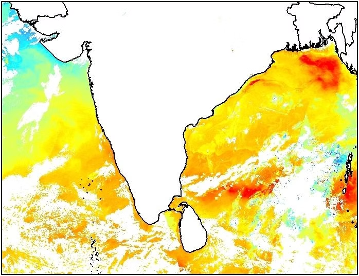
INCOIS uses satellite-derived sea surface temperature and chlorophyll information, along with other oceanographic inputs, to identify areas that may support fish aggregation. Its PFZ maps provide location information, including latitude, longitude, depth and distance from fishing landmarks.
This is therefore not a case of an app simply “finding fish”. It is a scientific forecasting tool that identifies conditions associated with likely fish aggregation.
WHY THIS MATTERS TO GOA
The biggest potential benefit is not technological. It is economic.
Fuel is one of the costs fishermen incur before they sell a single fish. Every unnecessary hour spent searching for shoals means additional fuel, labour and time.
And Goa already has evidence that PFZ information can make a difference.
An ICAR study based on 290 fishing experiments conducted along Goa between 2006 and 2012 found that purse-seine fishermen using PFZ advisories reduced scouting time by 50%. Mean catch per unit effort rose from 1,783.5 kg per hour in non-PFZ areas to 4,188.6 kg per hour in PFZ areas. The researchers calculated a 2.3-fold improvement in CPUE.
That is the real story behind the app.
Read Also: Goa’s Kunbi Weaving Legacy Continues on National Handloom Day
In August 2024, the Directorate of Fisheries, in collaboration with the Fishery Survey of India, organised a seminar on space-based observation for improving fisheries, attended by 105 fishermen from Mormugao fisheries societies. ISRO scientists explained Potential Fishing Zone technology and demonstrated transponders.
The state’s fisheries programme has also moved towards climate-resilient fishing villages, digital weather information and PFZ displays.
Sawant’s significance therefore lies in the broader policy environment that is pushing Goa’s traditional fishing economy towards scientific and technology-assisted decision-making.
THE TECHNOLOGY DID NOT START WITH THIS APP
Goa has been receiving satellite-derived fishing intelligence for years.
ICAR-CCARI identifies it as a system based on remote sensing and GIS, using satellite-derived chlorophyll and sea surface temperature. Its Goa work has reported reductions in search time and fuel use among fishermen using PFZ information.
Goa University’s own work also has a longer history. In 2025, the university said it was developing an app using satellite data to help traditional fishermen locate fish schools more efficiently. Earlier university material described research into satellite-based identification of Potential Fishing Zones.
The latest development is therefore better understood as the next step in a long scientific experiment, rather than a technology appearing overnight.
WHAT CHANGES FOR A FISHERMAN?
The potential change is practical.
A fisherman can use scientifically generated information before deciding where to search. That can help reduce wasted movement, fuel consumption and time at sea.
But PFZ information is not a guarantee of a catch.
INCOIS itself describes these zones as potential areas and warns that fishing zones can shift because ocean conditions are dynamic.
The strongest model is therefore not technology replacing traditional knowledge. It is technology giving traditional knowledge another layer of information.
THE GOVERNMENT’S POSITION
Goa’s Fisheries Department has been actively integrating scientific and digital tools into fisheries management.
The department already publishes satellite-based PFZ information for Goa and has used digital displays and scientific advisories to communicate fishing-zone information.
The Centre is also moving towards wider satellite-enabled fisheries infrastructure. In February 2026, the Union government approved a national rollout of satellite-based Vessel Communication and Support Systems for one lakh marine fishing vessels, with an outlay of ₹364 crore.
KEY DATA
1,28,378 tonnesGoa’s marine fish catch in 2024-25.
104 kmApproximate coastline used in ICAR’s Goa PFZ research.
50%Reduction in scouting time recorded in the ICAR PFZ validation study.
2.3xImprovement in catch per unit effort in PFZ areas.
₹2.72 lakhMean profit per operation recorded in PFZ areas in the study, compared with ₹0.86 lakh in non-PFZ
TIMELINE
1990: India begins the Marine Satellite Information Services programme to explore satellite data for ocean-resource applications.
2006-2012: ICAR conducts extensive PFZ validation work along Goa’s coast.
2016: ICAR publishes Goa-specific evidence showing major gains from PFZ advisories.
2024: Goa Fisheries and Fishery Survey of India conduct a space-based fisheries seminar with 105 fishermen.
2025: Goa University says it is developing a satellite-data application for traditional fishermen.
2026: The satellite-based fishing application moves towards implementation for fishermen in Goa.
THE BIGGER PICTURE
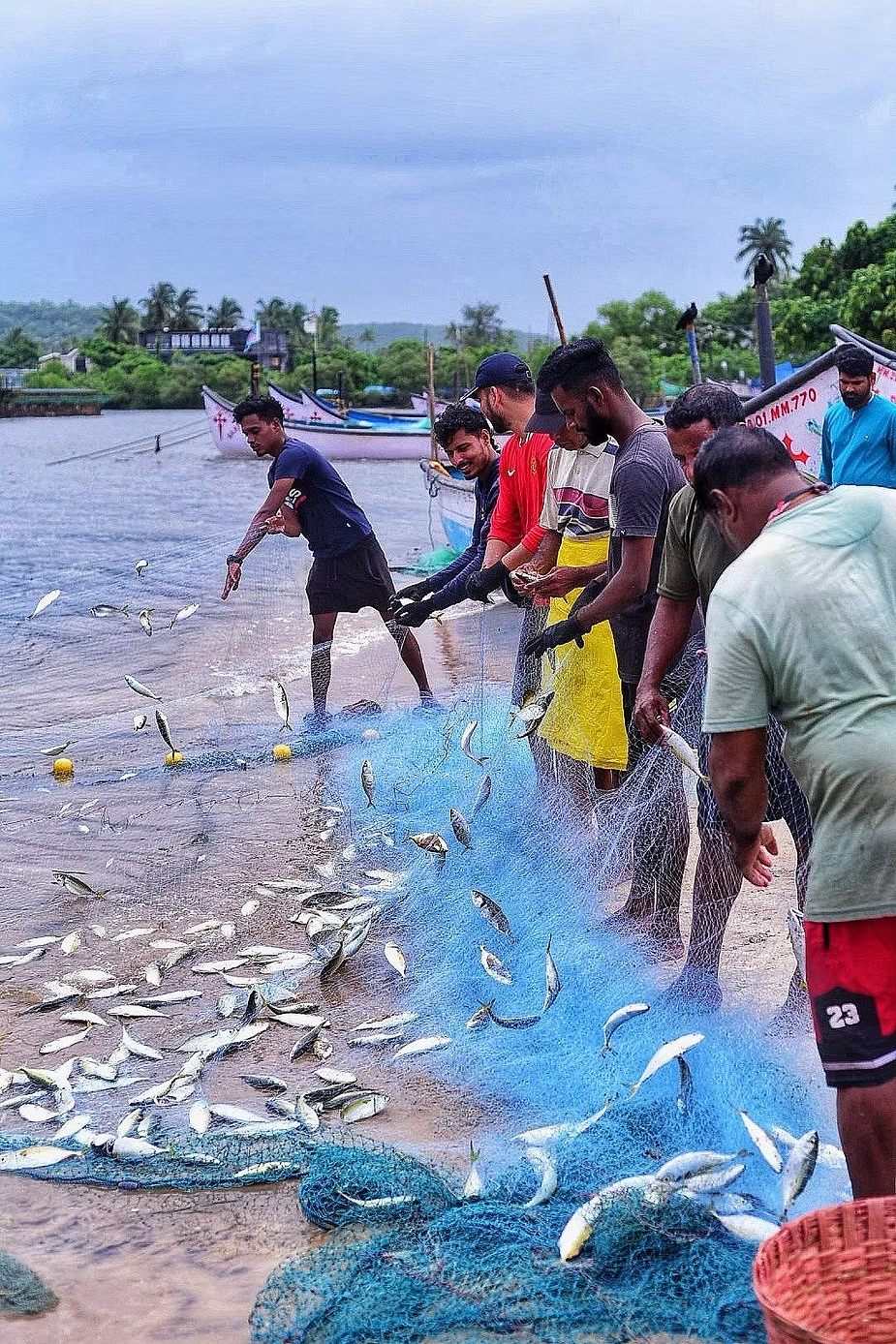
For Goa’s fishing community, the important development is not that a smartphone has entered the boat.
It is that decades of satellite science, oceanography and fisheries research are finally being pushed closer to the person who has to make the most expensive decision of the day: where to cast the net.
The sea will remain unpredictable. Fish will still move. Weather will still change.
But if a fisherman can leave shore knowing a little more about what lies ahead, that small advantage can translate into less fuel burned, less time wasted and a better chance of returning with a worthwhile catch.
For Goa, that is where space technology stops being something above us and starts becoming something that works for people on the ground, and at sea.
Read Also: 18,575 Goan artisans benefit from PM Vishwakarma Scheme